Plots of the u-v plane coverage with the VLBA for sources at
declinations of +64, +30, +06, and -18 degrees are shown in Figure
1 for horizon-to-horizon tracks and in Figure 2 for single
``snapshot'' tracks of duration ![]() hour approximately when the
source transits New Mexico. Similar plots can be generated with the
NRAO program SCHED (Walker 1997) or the Haystack program
PC-SCHED (see Section 26.1).
hour approximately when the
source transits New Mexico. Similar plots can be generated with the
NRAO program SCHED (Walker 1997) or the Haystack program
PC-SCHED (see Section 26.1).
0
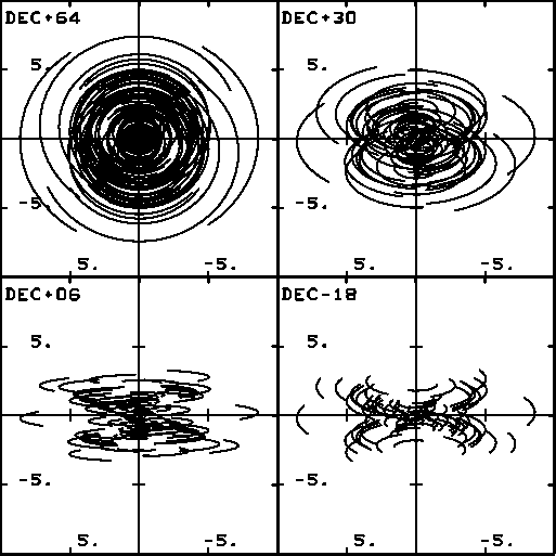
Figure 1:
VLBA u-v plane coverage at four declinations.
Horizon-to-horizon tracks for an elevation limit of ![]() .
Plotted range is
.
Plotted range is ![]() 9000 km.
9000 km.
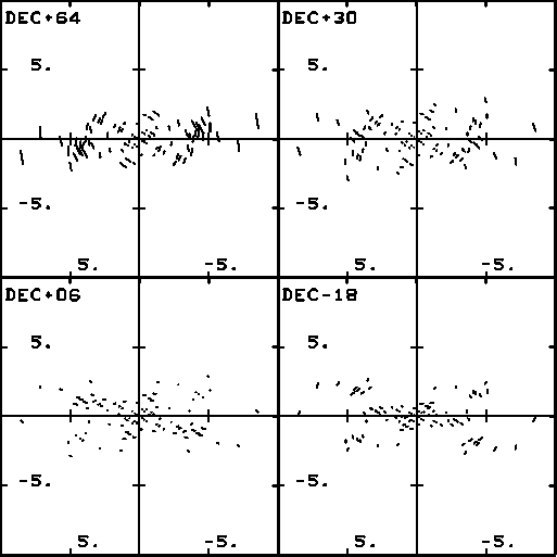
Figure 2:
VLBA u-v plane coverage at four declinations.
Single ``snapshot'' tracks at New Mexico transit.